

Events
family-loss

Existing-Land-Use-Map
A detailed map reflecting the current use of the property and wetlands.
east-coast-sup-plans-26nov10
dune-profile
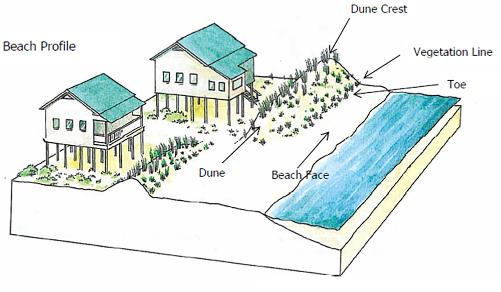
Diagram of a beach profile showing oceanfront homes behind a vegetated dune, with arrows identifying the dune crest, vegetation line, dune toe, dune, and beach face.
Dune-Fencing-Guidelines
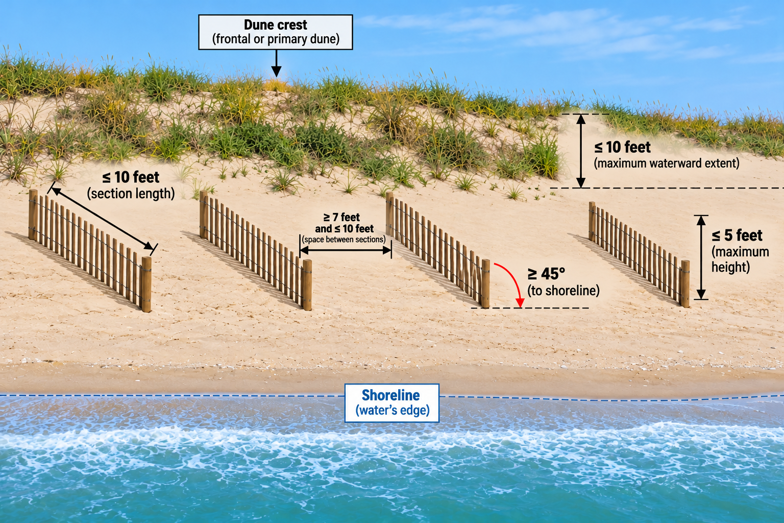
Currituck County Dune Fencing Guidelines
dry-det-basin
dry-det-basin
Division of Coastal Management Presentation
development-agreement-review-process
Updated March 2025