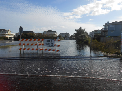
Flooded roadway in Corolla.
Flooding is the nation’s most common natural disaster! Currituck County can experience flooding from:
- heavy rainfall
- hurricanes
- tropical storms
- nor’easters
Heavy and prolonged rainfall can cause stormwater flooding. Essentially, rain accumulates faster than soils can absorb it.
Low elevations, flat topography, high groundwater tables, and poorly drained soils further complicate stormwater flooding within the County.
Hurricanes and tropical storms can bring heavy rain and storm surge. Storm surge and large battering waves from the Atlantic Ocean can result in:
- loss of life
- destruction of buildings
- erosion of beaches and dunes
- and damage to roads and bridges along the coast.
Storm surge can also occur along the Currituck Sound and Albemarle Sound depending on the angle at which a storm approaches the coast. Storm surge values do not correspond well with hurricane wind categories. Tropical storms, category 1 or 2 hurricanes, major (category 3 to 5) hurricanes, and post-tropical cyclones can all cause life-threatening storm surge.
Flood maps were developed to communicate flood risk. Knowing what your flood risk is can help you prepare before the storm.
It is important to know that your property may be susceptible to flooding, and your home may be in a repetitively flooded area. Contact the Planning and Community Development Department to find out the flood hazard for your property.
For example, Hurricane Matthew hit North Carolina on October 8, 2016, as a Category 1 storm. Communities were devastated by this slow-moving storm primarily by widespread rainfall. During a 36-hour period, up to 18 inches of heavy rainfall inundated areas in central and eastern North Carolina. 672 homes reported damage from this storm in Currituck County.
More information on the impacts of Hurricane Matthew and Currituck County’s response can be found in the May 2017 Hurricane Matthew Resilient Redevelopment Plan (PDF).
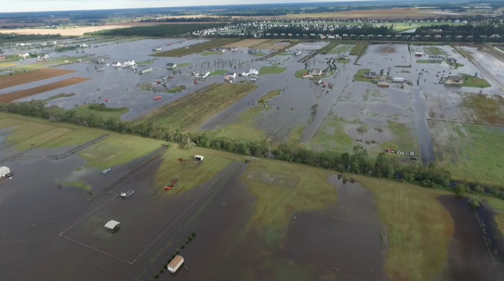
Aerial view of the flooding in Moyock during Hurricane Matthew.